Enlighten '10 Operations Index
Related Content

Washington Mooring Array

Operations
Operations on the Enlighten'10 expedition are focused on obtaining meter-scale ba ...
Mapping Washington Margin
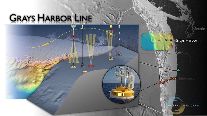
Site Characterization for Mooring West of Grays Harbor
Understanding river-influenced shelf ecosystems
The coastal margin west of Grays Harbor, Washington, will host three uncabled moorings as part of the Coastal Scale Nodes (CSN) component of the Ocean Observatories Initiative. This area is strongly influenced by fresh water issuing from the Strait of Juan de Fuca and from the Columbia River. Data from the mooring and glider arrays will be used to examine the dynamics of river-influenced shelf ecosystems, the impacts of ocean acidification, and El Niño and La Niña events within this highly dynamic system. To optimally place the deeper-water mooring (500 m water depth), this cruise will utilize the RESON high-resolution mapping system on the Autonomous Underwater Vehicle Sentry to produce a meter-scale resolution bathymetric map. We will also obtain direct observations of the seafloor using the robotic vehicle Jason.