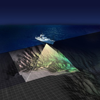
EM 300 Sonar
The EM300 is a type of sonar used to make regional maps of the seafloor.
Less than 10 percent of the seafloor has been properly mapped, yet understanding the topography of the seafloor—the bathymetry—is required to safely install the regional scale nodes observatory. In addition to using the mapping capabilities of the ROV Jason and AUV Sentry during this cruise, scientists will use also the EM300 system that is mounted on the hull of the R/V Thomas G. Thompson. This multibeam echosounder sends out multiple waves of sound (pings of 30 kHz acoustic energy) that cover a distance on the seafloor that is roughly equal to two times the water depth. The sound signals that bounce off the seafloor are received back at the ship at different times. Computers on the ship process this information to determine water depth, which is then plotted as a bathymetric map. On this cruise, we expect the EM300 to generate maps at 50-meter resolution. Data collected from EM300 surveys are used to generate base maps that cover more extensive areas of the seafloor that we can then use for planning higher resolution near-bottom surveys with vehicles like Sentry and Jason.

