Enlighten '10 Operations Index
Related Content
Axial Volcano

Operations
Operations on the Enlighten'10 expedition are focused on obtaining meter-scale ba ...
Mapping Axial Volcano
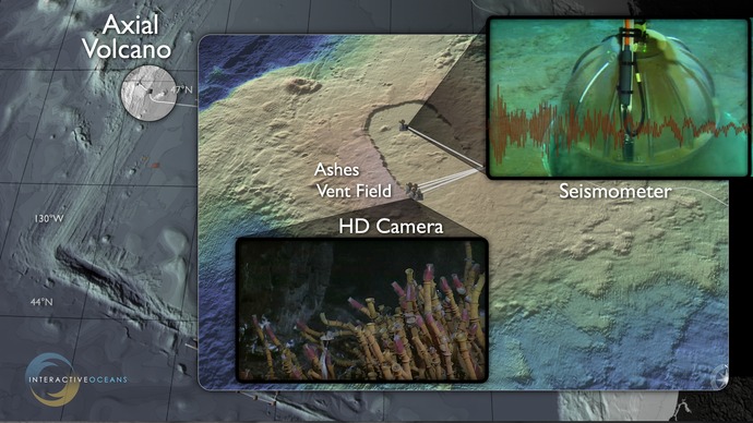
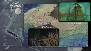
Real-time monitoring of the most robust volcano on the Juan de Fuca Ridge
Over 60% of the volcanism on the planet occurs within the world's oceans
In 2013, as part of NSF's Ocean Observatories Initiative, Axial Volcano will be the site of a major installation of seafloor biological, chemical, and geophysical sensors cabled to the Internet. In concert, this array will provide unparalleled new insights into how submarine volcanoes work, how seismic events perturb seafloor hot spring systems, and the temporal and spatial evolution of novel life forms that thrive in these extreme environments.
High-resolution mapping during Enlighten '10 using a RESON sonar mounted on the ROV Jason will provide meter-scale resolution maps of the seafloor that are critical to the design and installation of this seafloor high power and bandwidth observatory. Direct observations will allow optimal slection of active black smoker sites for deployment of a high definition camera, and other in situ sensors that include a mass spectrometer, coupled DNA and fluid sampler, and seismometers. More than 30 sensors at this site to be connected to fiber-optic cables, allowing two-way real-time communication through the Internet that includes direct viewing of live, streaming imagery from digital-still and high-definition cameras.