
The Thompson
The 274-foot R/V Thomas G. Thompson is a global class research ship that is ...
EM302 Echosounder

Hull-mounted Multibeam Echosounder
Hull-mounted Multibeam Echosounder
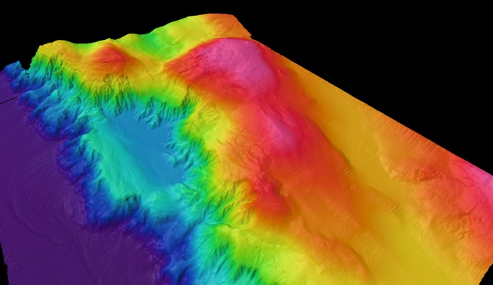
Less than 10% of the seafloor has been properly mapped, yet understanding the topography of the seafloor -- the bathymetry -- is required to safely install components of the Ocean Observatories Initiative. In addition to using the ROV ROPOS during this cruise for visual observations of the seafloor, scientists will also use the Konsberg EM302 multibeam echosounder that is mounted on the hull of the R/V Thomas G. Thompson.
The EM302 multibeam echosounder sends out multiple waves of sound (pings of 30kHz acoustic energy) that cover a area on the seafloor that is roughly equal to 2x the water depth. The sound signals that bounce off the seafloor are received back at the ship at different times. Computers on the ship then process this information to determine water depth, which is then used by scientists to plot bathymetric maps. During this cruise, data collected with the EM302 surveys will be used to generate maps of the OOI cabled observatory's primary study sites. Additionally, we hope to use the EM302 to detect and map bubble plumes from active methane seeps at Southern Hydrate Ridge.