I am now a senior and participating in VISIONS’11 for my senior thesis project which will be analyzing geologic morphology of ASHES vent field.
Files
Dustin Anctil
Dustin Anctil
Day 9
Sunday, August 28, 2011
August 27th, 2011 – Day 9 – On watch this morning, we were on Dive 1470 which started at International District to do a survey of the sea floor. We were trying to find a good flat and relatively safe location for the future install of the primary node for RSN. Later in the morning, chief scientist John Delaney woke me up to go on a small boat ride to retrieve a transponder that was cut from the sea floor. The transponder surfaced about 150 meters off the bow and we reeled it in from the small boat. Later on in the evening we had a steel beach picnic and a photo-op. A steel beach picnic is a barbecue on the fantail of the ship for those not familiar with seafaring terminology.
Day 8
Sunday, August 28, 2011
August 26th, 2011 – Day 8 – When I took the watch this morning, we were on Dive 1469 which started in ASHES vent field to deploy a vent camera. Then we started the long journey of surveying the proposed cable route. On the way out of ASHES, I had another opportunity to photograph the perimeter of ASHES vent field for my project. The rest of the day was slightly less eventful until Tina’s presentation on Automated Underwater Vehicles (AUV), aka gliders, which glide through the water with a sensor package and take readings the whole time. If you’re interested in the future of oceanography, I suspect these AUV’s will be playing a major role.
Day7
Sunday, August 28, 2011
August 25th, 2011 – Day 7 – This morning, I was finally able to get data for my project. During this Dive (1468), we were taking samples for Monica’s masters project which ended mostly with no good samples. They plan to return at a later dive and try again. After that was finished, we moved into position to run a transect from the east end of ASHES to the northwest end of ASHES so I could photograph the perimeter on both sides. I didn’t get good photos of the eastern end, but I did get good photos of the northwestern end. I suspect that I will have another chance on later dives. Later in the evening, we had a large science meeting for the first time since day 2 and scheduled multiple meetings for the rest of the cruise.
Day 4
Tuesday, August 23, 2011
August 22nd, 2011 -- Day 4 -- I had my first watch today is a logger for ROPOS dive 1465 from 0000-0400. My job as a logger was to photograph and make log entries into a computer based log system called IRLS. It was pretty intense because I had to take photographs on one computer with my left hand and make log entries on another computer with my right hand. At 0200 there was a problem with the ROPOS hydraulic tank and they had to cancel dive 1465 and bring ROPOS back to fix it. It took about an hour for ROPOS to ascend from about 1600m depth and was brought on board at around 0300. It took a couple hours to fix and ROPOS was back in the water around 0500 on dive 1466 to continue the cable survey. Later in the evening, I got to look at a nice sunset for the first time we've been under way since its been overcast skies until today.
Day 3
Monday, August 22, 2011
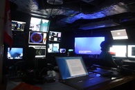
August 21st, 2011 – DAY 3 - Today, I learned how to add track layers into ArcGIS mapping software. I added several ROPOS dive tracks from the first leg of the cruise into the mapping software. ROPOS tracks at 5 Hz so there were hundreds of thousands of entries to upload which proved to be an issue with older excel documents which could keep track of about 64 thousand. A simple switch from excel files to csv files solved the problem though. ROPOS started dive 1465 to survey the RSN cable this afternoon which was amazing to watch. It descended to 1000m before the ship received updated track information on where the RSN cable actually was so we steamed for a couple hours at half a knot to where the cable was and ROPOS descended the rest of the way.
Geology of ASHES Vent Field Topic Summary
Sunday, August 21, 2011
Topic Summary
A tentative title for my project is “Using Sea Floor Imagery to Determine the Geologic Setting of ASHES Vent Field.” The goal of this project is to examine the geologic setting of ASHES vent field on Axial Seamount, Juan de Fuca Ridge to test two hypotheses. The first hypothesis is that the ASHES vent field was created by the collapse of a magma chamber during lava drainback creating a collapsed basin. The second hypothesis is that the vent field basin is sea floor surrounded by more recent lava flows from Axial Seamount. Models by Butterfield et al (1990) suggest that the hydrothermal field is fed by fluids migrating up a zone of high permeability beneath ASHES vent field. Measurements by Gilbert et al (2007) have determined the sea floor around axial seamount to be porous with low density consisting of both large lava drain backs and open pillow basalts. Recent seismic topographic mapping has confirmed the existence of a pool of partial melt 1-2.5 km below the Axial Seamount caldera (West et al. 2003; Canales et al. 2009). Close examination of the geology in and around ASHES vent field will provide insight as to how the vent field was formed and what drives its venting. Adobe Photoshop will be used to photomosaic thousands of images into high resolution bathymetry cross sections of ASHES vent field basin walls. To accomplish this task, bathymetry from the robotic vehicle ROPOS will be downloaded to hard disk in the form of high definition images from a Zeus Plus high definition camera. After the images and video have been obtained, they will be processed through Adobe Photoshop to create high resolution cross sections of the basin walls. The images will then be analyzed to determine whether ASHES vent field was created by the collapse of a magma chamber or surrounded by lava flows built up over time. If the images reveal mostly intact lava flows as basin walls then AHSES vent field is sea floor surrounded by more recent lava flows from Axial Seamount. If the images reveal near vertical walls with jagged edges, then ASHES vent field was created by the collapse of a magma chamber during lava drainback. However, jumbled sheet flows with rubbly surfaces are not indicative of lava drainback (Hammond 1990). Determining the geologic setting of ASHES vent field will further understanding of geological controls on vent distribution and serve as a base for further investigation into geological studies of ASHES vent field (Hammond 1990). These images will be taken along the Axial Seamount and Ashe’s Vent Field 250 miles off the Oregon coast. This study will be completed on the Visions’11 cruise from August 19, 2011 to September 1, 2011. These operations will be supervised and administered by Dr. Deborah Kelley and Dr. John Delaney.
References
Butterfield, D. et al. 1990. Geochemistry of Hydrothermal Fluids From Axial Seamount Hydrothermal Emissions Study Vent Field, Juan de Fuca Ridge: Subseafloor Boiling and Subsequent Fluid-Rock Interaction. Journal of Geophysical Research. 95: 12895-12921.
Canales, J. et al. 2009. Sesmic reflection images of a near-axis melt sill within the lower crust at the Juan de Fuca ridge. Nature. 460: 89-93. doi: 10.1038/nature08095
Gilbert, L. et al. 2007. Porosity of the upper edifice of Axial Seamount. Geological Society of America. 35: 49-52. doi: 10.1130/G22892A.1
Hammond, S. 1990. Relationships Between Lava Types, Seafloor Morphology, and the Occurrence of Hydrothermal Venting in the ASHES Vent Field of Axial Volcano. Journal of Geophysical Research. 95: 12875-12893.
West, M. et al. 2001. Magma storage beneath Axial volcano on the Juan de Fuca mid-ocean ridge. Nature. 413: 833-836.
Days 1 & 2
Sunday, August 21, 2011
August 19th, 2011 – DAY 1 – We (the students of OCEAN 411) boarded the vans at 0700 in Seattle and departed for Newport OR to board the RV Thompson. It was a seven hour drive with a couple stops for food along the way until we finally drove down the pier to board the Thompson. We loaded all our equipment and belongings and were underway around 1700. As soon as we pulled out of the harbor, the wind and seas picked up. Many of us who just boarded got seasick, including myself. I spent the rest of the evening laying down trying not to start what would have inevitably been a chain reaction of vomiting among the newcomers.
August 20th, 2011 – Day 2 – I woke up feeling a little better and tried to eat some breakfast. Later on in the mo9rning we had a fire and abandon ship drill where we all mustered in the science lab and went over different types of fires how to combat them. In the afternoon we had a science meeting and went over the different projects that people were conducting prioritized them and made a rough timeline for the remaining 2 weeks of operation. It looks like I will be able to get photos from ASHES vent field for my project around August 24th. Operational timelines are extremely fluid so that could change at any time.