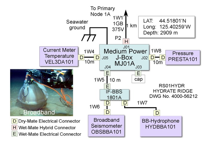
Subset of BCSM

A subset of the Site 1, Hydrate Ridge Functional Block Diagram (4511-56212) showing the layout for the Basic Core Seafloor Measurements Package that will be installed at two of the Primary Nodes. These packages are located 1 km away from the Primary Nodes. Also shown is a broadband sensor in a titanium housing just prior to deployment by a remotely operated vehicle.

For commercial use or higher resolution please contact Nancy Penrose
