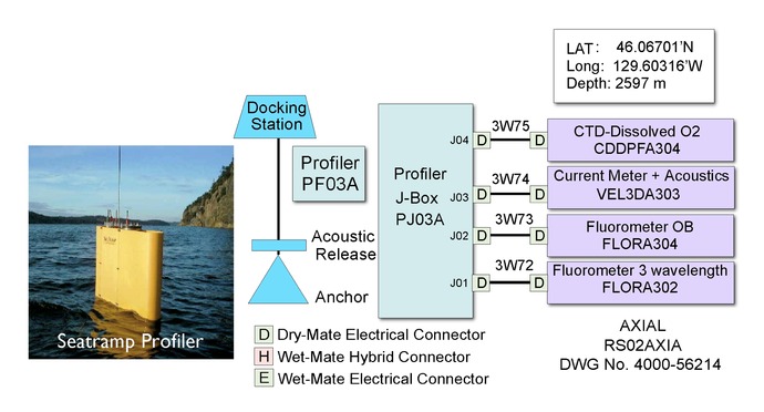
Profiling Instruments Block Diagram

A Block Diagram for the Profiling Instruments Package for the water column mooring located 1.0 km NW of Primary Node 3A near the base of Axial Seamount. The image to the left shows Seatramp Profiler being deployed as an example profiler.

For commercial use or higher resolution please contact Nancy Penrose
