Enlighten '10 Technology
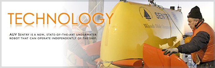
To optimally explore, map and sample the dark, deep seafloor requires a suite of vehicles and instruments. Mapping of the seabed is critical in engineering a safe and secure node deployment site and cable route for the fiber optic network that makes up the Regional Scale Nodes (RSN) component of the Ocean Observatories Initiative. To optimize the longevity and security of the cables, nodes, and sensors, we must collect the best possible information about the seafloor shape and dynamics. On this cruise, we are using the EM300 mounted on the hull of the R/V Thomas G. Thompson, the AUV Sentry, and the ROV Jason 2 to create detailed maps and photomosaics of the RSN deployment sites. Additionally, we will be using a CTD, a gravity corer, and a chirp sub-bottom profiler to supplement this data.