COVE Enlighten
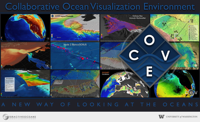
COVE (Collaborative Ocean Visualization Environment) combines the geobrowser interfaces of such tools as Google Earth and Virtual Earth.
COVE is a software application built in an active collaboration between the University of Washington Department of Computer Science and Engineering and the scientists and engineers developing the Regional Scale Nodes program within the NSF Ocean Observatories Initiative.
COVE combines the geobrowser interfaces of such tools as Google Earth and Virtual Earth with flexible terrain integration, task specific editing mechanisms, and 3D dataset exploration. COVE allows collaboration across the team on tasks such as cable layout, instrument locations, historical and newly acquired bathymetry sets, and viewing images and video of the sea bottom in situ.
For example, on the InSite08. OOI mapping cruise in summer 2008, COVE was used in the planning, monitoring, and viewing of collected data. Tracks for the R/V Thompson and the AUV Sentry were laid out quickly and interactively to determine the best possible runs. Waypoints were then passed to the operators of the ship and AUV. As the routes were followed, annotations were entered to check the progress of the actual runs against the plan. Finally, after the data sets had been cleaned up by specialized tools such as Fledermaus, they could be viewed against historical bathymetry sets to determine where to go next. This visual, interactive environment greatly simplified the process of viewing data, determining data value, and planning next steps. We will use COVE during Enlighten '10 to aid in AUV and ROV survey planning and to view the processed data once the surveys are complete.
COVE is the thesis topic of Keith Grochow, a graduate student in the University of Washington Department of Computer Science and Engineering. His interests are in human-computer interaction and visualization. COVE focuses on scientific tools and how visual interfaces can be useful to the oceanographic community.