April 2010
RSN cable route survey cruise begins
Thursday, April 01, 2010
From Cecile Durand on RSN cable route survey cruise
The R/V Mount Mitchell, a 231’ hydrographic research vessel managed by Global Seas LLC in Seattle, set sail on April 1 to begin the Regional Scale Nodes Cable Route Survey. Equipped with Kongsberg EM 120 and EM 710 High Resolution Multibeam Mapping Systems, the vessel was chartered by Williamson and Associates, the contractor responsible for the RSN cable route mapping. RSN Operations Manager Cecile Durand is onboard for the first leg of the survey and sent back this video of the ship's passage through the Ballard Locks.
Burial Assessment Survey Com ...
Monday, May 17, 2010
Report from Brian Ittig, RSN Marine Operations Manager The RSN burial and assessment survey (BAS) began on April 28, 2010 a ...
990 km of Cable Route Survey ...
Monday, April 19, 2010
All of our deep-water surveys from Axial seamount to the base of Oregon’s continental slope are now complete. This totals about 990km of ca ...
Survey lab
Saturday, April 10, 2010
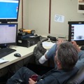
The survey team consists of surveyors, engineers, data processors, and one geologist. Video shows the survey lab onboard the Mt. Mitchell as the fir ...
Crabs for dinner
Saturday, April 10, 2010
The Pacific Rebel fishing boat has caught up with us some 40 miles offshore Pacific City and has delivered the C3D part we have been waitin ...
Waiting for a spare part
Friday, April 09, 2010
Our primary survey tool in shallow water (<1500 m), the C3D, has not been working. We’re waiting for a spare part to be delivered off ...
Better weather on the way
Tuesday, April 06, 2010
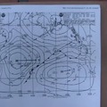
The Mt. Mitchell arrived on site April 4, but weather still unfavorable through April 5. EM120 survey attempted. Data noisy but usable. Finally, Apr ...
103 knot winds!
Friday, April 02, 2010
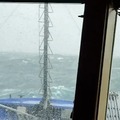
Rough seas and wind gusts near Cape Flattery as high as 103 knots hindered the Mt Mtichells's progress toward the area of operations off Pacific Cit ...
