
Ocean Observing in th ...
A representative suite of natural phenomena that occur in the Northeast Pacific O ...


Observatories
We must understand the oceans to optimize the benefits and mitigate the hazards o ...
IOOS
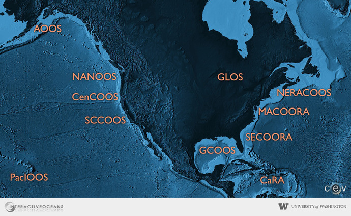
Integrated Ocean Observing System
The Integrated Ocean Observing System (IOOS) is a federal, regional, and private-sector partnership working to enhance the ability to collect, deliver, and use information in US coastal waters, Great Lakes and the oceans. IOOS is the U.S. contribution to the Global Ocean Observing System for sustained ocean observations designed to improve weather forecasts and climate predictions. IOOS helps deliver data and information needed to increase understanding of the oceans and coasts, facilitating the ability to make informed policy decisions and to monitor and predict changes in coastal and ocean ecosytsems and environments. IOOS represents a national partnership in which 17 Federal agencies and 11 Regional Associations share responsibility for the design, operation, and improvement of the national, coastal network of observations. IOOS contributes to understanding ocean processes within the Pacific Northwest through their Regional Association Northwest Association of Networked Ocean Observing Systems (NANOOS).