
Visions'11 Cruise
VISIONS '11 put to sea on August 11. Follow the cruise on the expedition website. ...


VISIONS'05
The VISIONS '05 expedition was a highly interdisciplinary, complex cruise focused ...

Learning at Sea
For over two decades the University of Washington has enabled at-sea experiences ...
Expeditions
Expedition Overview
Because the OOI Regional Scale Nodes system is designed to last 25 to 30 years, the primary nodes and backbone cable must be installed in seafloor areas that are relatively benign.

R/V Thompson 200 miles off of the Washington coast in 2005
R V Thompson
University students participate in at-sea expeditions aboard the University of Washington's Research Vessel Thomas G. Thompson. Students conduct research projects overseen by the expedition leaders who are also faculty members at the University of Washington.
Activities on a Cruise
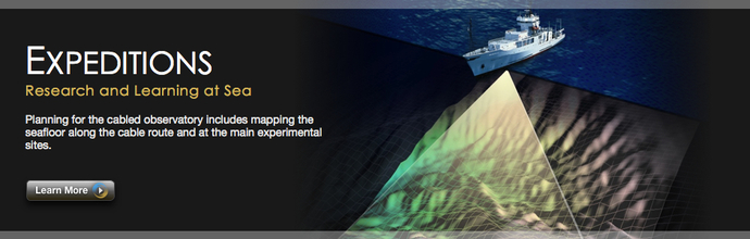
Planning for construction of the OOI Regional Scale Nodes cabled observatory includes overview and high-resolution mapping of the seafloor along the cable route and at the two main experimental sites: Hydrate Ridge and Axial Volcano.
Activities on the summer 2008 Insite08 cruise and the summer 2009 Lumens09 cruise include the use of the EM300 multibeam sonar, which is mounted on the hull of the R/V Thomas G. Thompson. The EM300 is used to create maps of the seafloor that provide an overview of the areas of interest. High-resolution mapping is accomplished using the state-of-the-art Autonomous Underwater Vehicle Sentry in a collaboration with the Woods Hole Oceanographic Research Institution. A deep-towed digital camera, TowCam, is used to photograph detailed characteristics of the seafloor to ensure that no hazards such as submarine landslides will occur in the selected area.
In 2010, 13 undergraduate and graduate students participated in the ENLIGHTEN '10 Expedition. The primary purpose of this research cruise, which sailed on the University of Washington's R/V Thomas G. Thompson, was to map and photograph the seafloor in preparation for the installation of secondary infrastructure (nodes, junction boxes, sensors, moorings, and extension cables) for the OOI RSN. Student projects ranged from groundtruthing bathymetry to changes in plankton population depth profiles, from describing currents to lava morphologies.
Why Map the Seafloor?
Existing maps are inadequate for the purposes of safely installing primary nodes on the main cable or secondary cables that will extend the footprint of the main experimental sites. Because the Regional Scale Nodes system is designed to last 25 to 30 years, the primary nodes and backbone cable must be installed in seafloor areas that are relatively benign: the node sites must be relatively flat and the route of the cable should not pass through steeply angled portions of the seafloor. In addition, areas to avoid include sites where mapping reveals past undersea landslide activity. Landslides are capable of severing a telecommunications cable.