Enlighten '10
  • Other Sites
    • VISIONS '11
    • ENLIGHTEN '10
    • University of Washington
  • Home
  • Cruise
    • Overview
    • Daily Log
    • OOI
    • Partnerships
    • Participants
    • Mission
  • Operations
    • Overview
    • Sediment Sampling
    • Water Sampling
    • Mapping Washington Margin
    • Mapping Hydrate Ridge
    • Mapping Axial Volcano
  • Education
    • Overview
    • Sea-going Research & Discovery
    • Student Projects
  • Science
    • Overview
    • Endurance Line
    • Axial Volcano
    • Hydrate Ridge
    • Washington Uncabled Line
  • Technology
    • Overview
    • Satellite
    • Reson Sonar
    • Chirp Sonar
    • HD Imagery
    • ROV Jason
    • AUV Sentry
    • CTD
    • Gravity Core
    • COVE
    • EM 300 Sonar
    • RV Thompson
  • Arts
    • Poetry
  • Gallery
    • Shipboard Images
    • Seafloor Images
    • Documents
    • Samples
    • Maps
  • Video

Mooring for the proposed 500m Endurance Array site

Mooring for the proposed 500m Endurance Array site

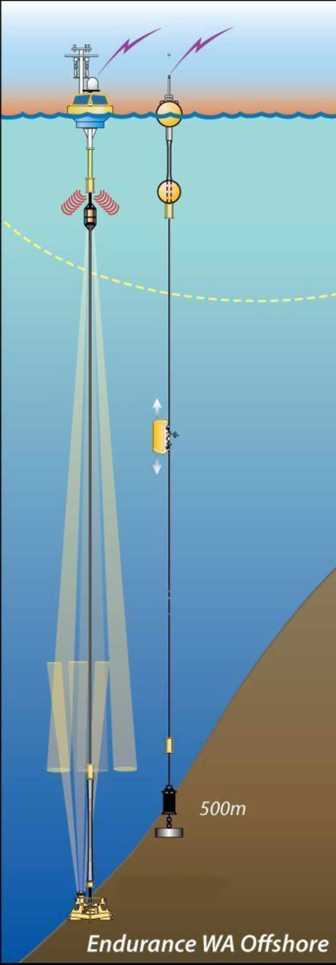
Schematic diagram of the mooring for the proposed 500 m Endurance Array site off the coast of Grays Harbor, WA. More information on the mooring can be found here. 

Creative Commons License 

For commercial use or higher resolution please contact Nancy Penrose


Enlighten '10
Follow us on Facebook
Follow us on Twitter
YouTube
Flickr

University of Washington. All rights reserved. Website Development and Design: Center for Environmental Visualization