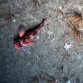
Flatfish During Grays Canyon Survey
Flatfish on bottom during Jason dive 507 at the potential site for the 500 m moorings.
Related Stories

For commercial use or higher resolution please contact Nancy Penrose