Enlighten '10
  • Other Sites
    • VISIONS '11
    • ENLIGHTEN '10
    • University of Washington
  • Home
  • Cruise
    • Overview
    • Daily Log
    • OOI
    • Partnerships
    • Participants
    • Mission
  • Operations
    • Overview
    • Sediment Sampling
    • Water Sampling
    • Mapping Washington Margin
    • Mapping Hydrate Ridge
    • Mapping Axial Volcano
  • Education
    • Overview
    • Sea-going Research & Discovery
    • Student Projects
  • Science
    • Overview
    • Axial Volcano
    • Endurance Line
    • Hydrate Ridge
    • Washington Uncabled Line
  • Technology
    • Overview
    • Satellite
    • Reson Sonar
    • Chirp Sonar
    • HD Imagery
    • ROV Jason
    • AUV Sentry
    • Gravity Core
    • CTD
    • COVE
    • EM 300 Sonar
    • RV Thompson
  • Arts
    • Poetry
  • Gallery
    • Shipboard Images
    • Seafloor Images
    • Documents
    • Samples
    • Maps
  • Video

ENLIGHTEN'10 Main Image

ENLIGHTEN'10 Main Image

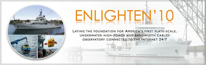
The Research Vessel Thomas G. Thompson works throughout the world’s ocean basins and is the vessel being used for this July 2008 node survey cruise of the Ocean Observatories Initiative.

Creative Commons License 

For commercial use or higher resolution please contact Nancy Penrose


Enlighten '10
Follow us on Facebook
Follow us on Twitter
YouTube
Flickr

University of Washington. All rights reserved. Website Development and Design: Center for Environmental Visualization